Coming soon to iOS & Android

The whole mountain, in your pocket.

Kopaonik, Zlatibor and Stara planina in one free app. A 3D map of every piste, routes that chain lifts and runs together, live lift status, mountain weather, and every place worth knowing about, from the first chair to the last run.

Kopaonik, Zlatibor and Stara planina in one free app. Once the snow goes the same map carries the hiking tours, the picnic spots and the viewpoints, with the weather on the mountain, the places around you and the news of the day.

Free. No account needed for the map, lifts, weather and news.

  • 3 mountains
  • Winter & green season
  • Hiking trails & picnic spots
  • 9 languages
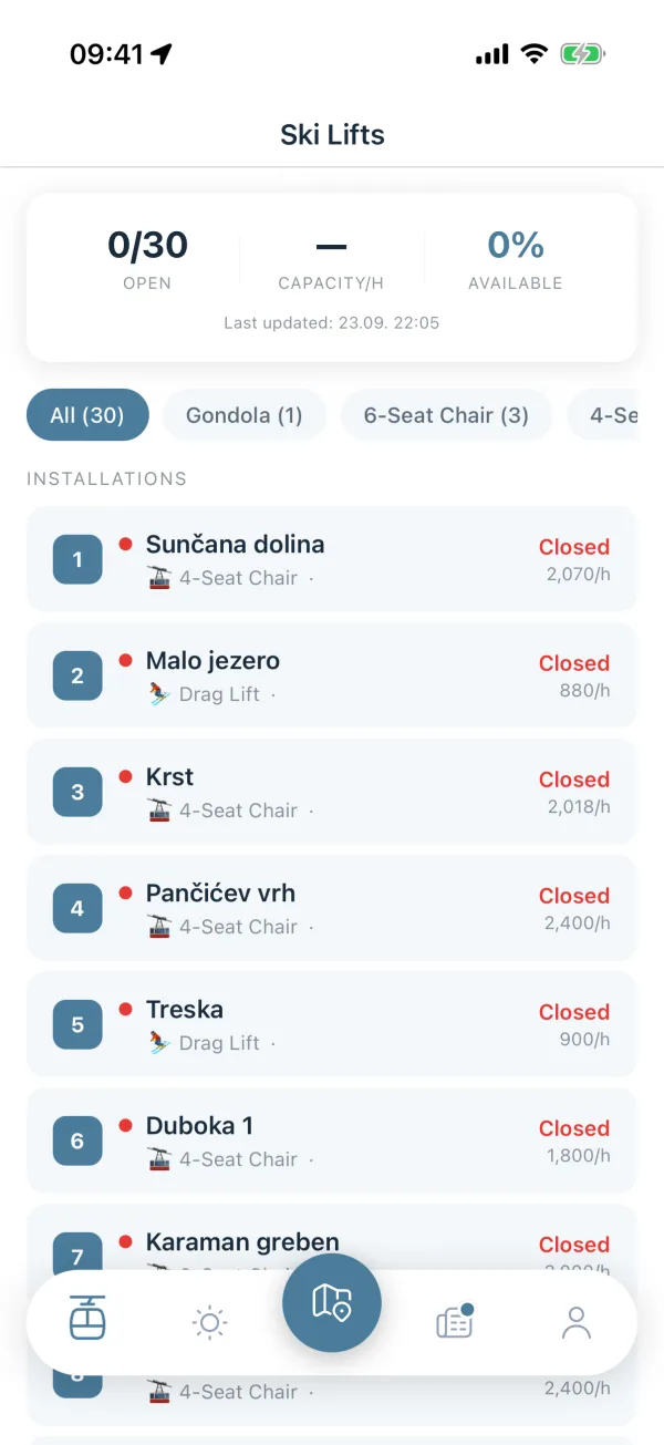
Ski Lifts screen with the open count at the top, filter chips by lift type, and a list of lifts with status, type and hourly capacity.
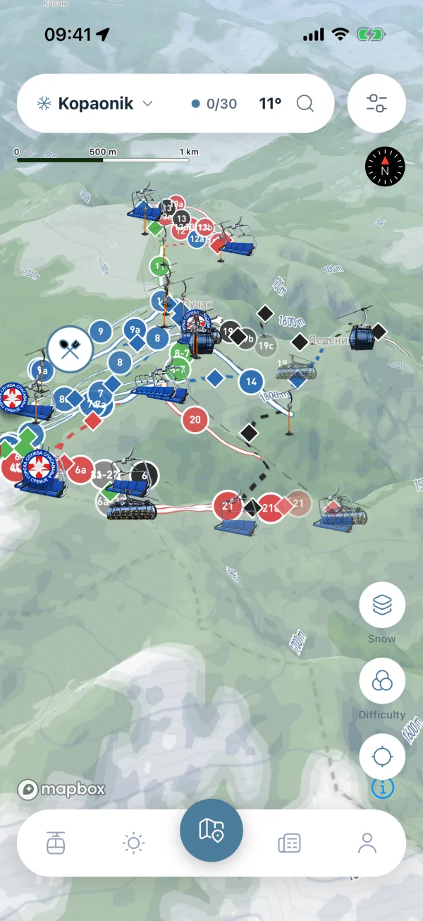
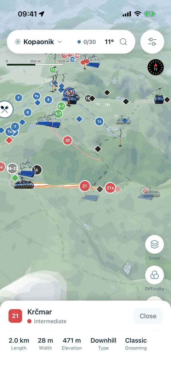
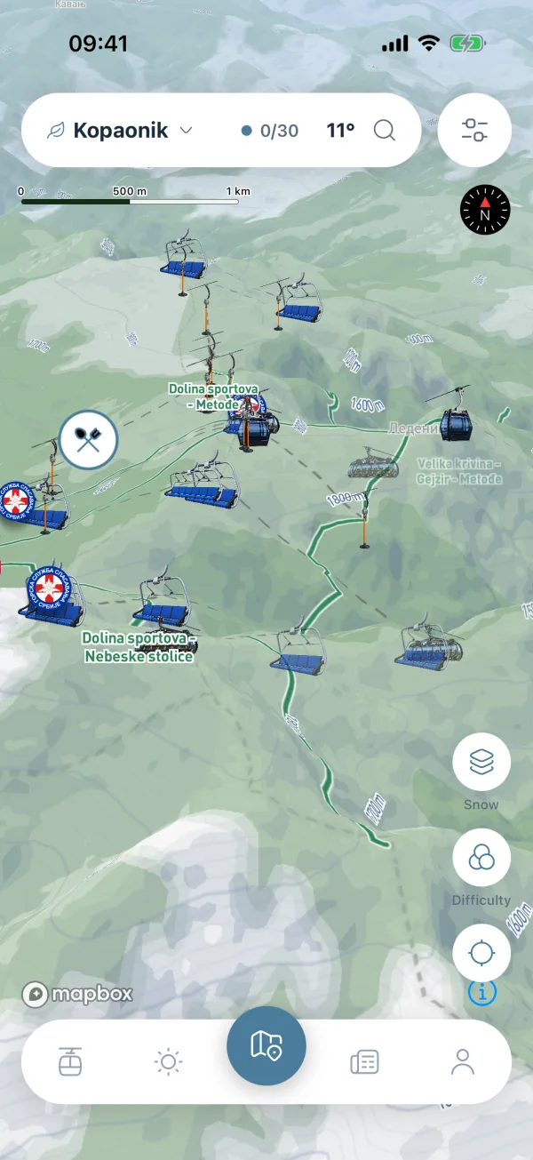
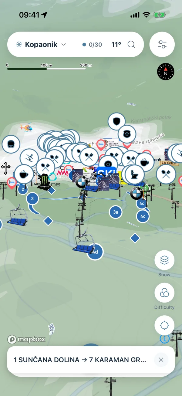
Overview of Kopaonik's lifts and pistes on 3D terrain, with a header island showing the mountain name, the number of open lifts and the temperature. Map with a piste's info panel open, showing its name, difficulty, length, width, elevation, type and grooming. The chosen route drawn on the map in blue, with a bar at the bottom naming its start and end.
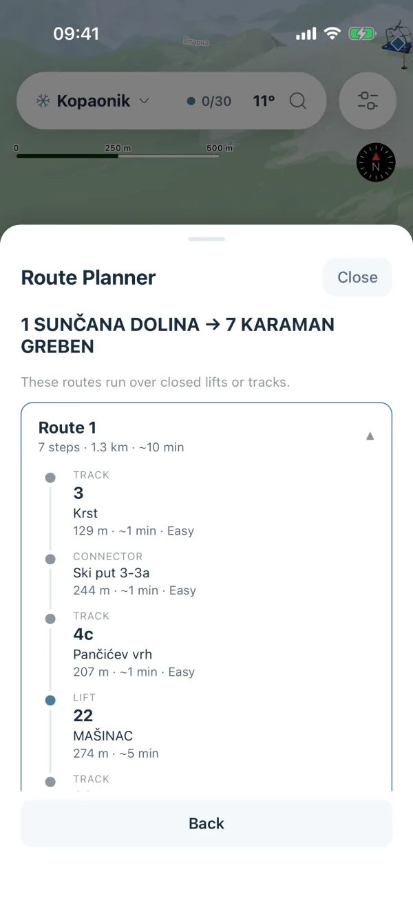
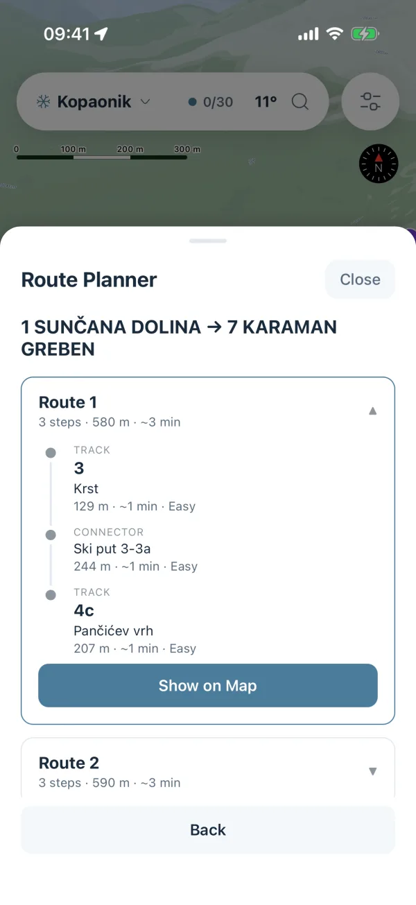
Route planner sheet with a start and an end, and a route broken into steps with the name, length and minutes of each.
Ski Lifts screen with the open count at the top, filter chips by lift type, and a list of lifts with status, type and hourly capacity.
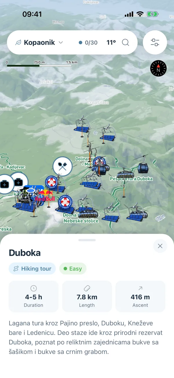
Green season on Kopaonik: the pistes are gone and hiking trails are drawn on summer terrain, with a leaf next to the mountain name. Map with a hiking trail's info panel open, showing its name, difficulty, how long it takes and whether it is open. A hiking trail drawn on the map, with a bar at the bottom naming where it starts and where it ends.
Hiking tours list with each tour's difficulty, how long it takes and whether it is open.

Three mountains at launch

Pick a mountain. Or let it find you.

The mountain picker sits in the header. Allow location and the app opens on the nearest one: the map, the lifts, the weather and the news all follow it.

  • Kopaonik

    Serbia's biggest ski area, mapped piste by piste, with night skiing and a live weather station on the mountain.

  • Zlatibor

    Gentle runs for families in winter, and a long green season of hiking trails and picnic spots.

  • Stara planina

    Long descents on the Bulgarian border, with the hiking network waiting once the snow goes.

  • 3Mountains
  • 5Difficulty grades
  • 7Day forecast
  • 9Languages

Map & seasons

Every piste, in 3D terrain.

Snow, Terrain or Satellite, on real Mapbox 3D terrain. Pistes are coloured by difficulty: novice, easy, intermediate, advanced and expert. Switch to colour by availability when you only want to know what is open. Lifts, pylons and ski roads are drawn in too.

  • Tap a piste for length, width, elevation, type, grooming and night skiing.
  • Colour by difficulty, or by open / limited / closed.
  • Green season swaps pistes for hiking trails with duration, ascent, descent and picnic areas.

Map & seasons

Every trail, on the same 3D terrain.

Snow, Terrain or Satellite, on real Mapbox 3D terrain. In the green season the pistes give way to hiking trails and picnic spots, drawn over summer ground. Everything else stays where it was: the same three mountains, the same search, the same places around you.

  • Tap a trail for its difficulty, how long it takes and whether it is open.
  • Picnic spots sit on the map next to the trails, with the same tap for details.
  • Switch back to winter and the pistes are there again, on all three mountains.
Map with a piste's info panel open, showing its name, difficulty, length, width, elevation, type and grooming.
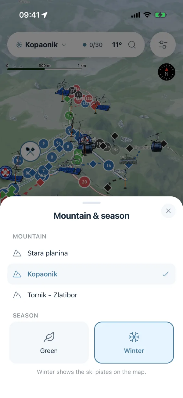
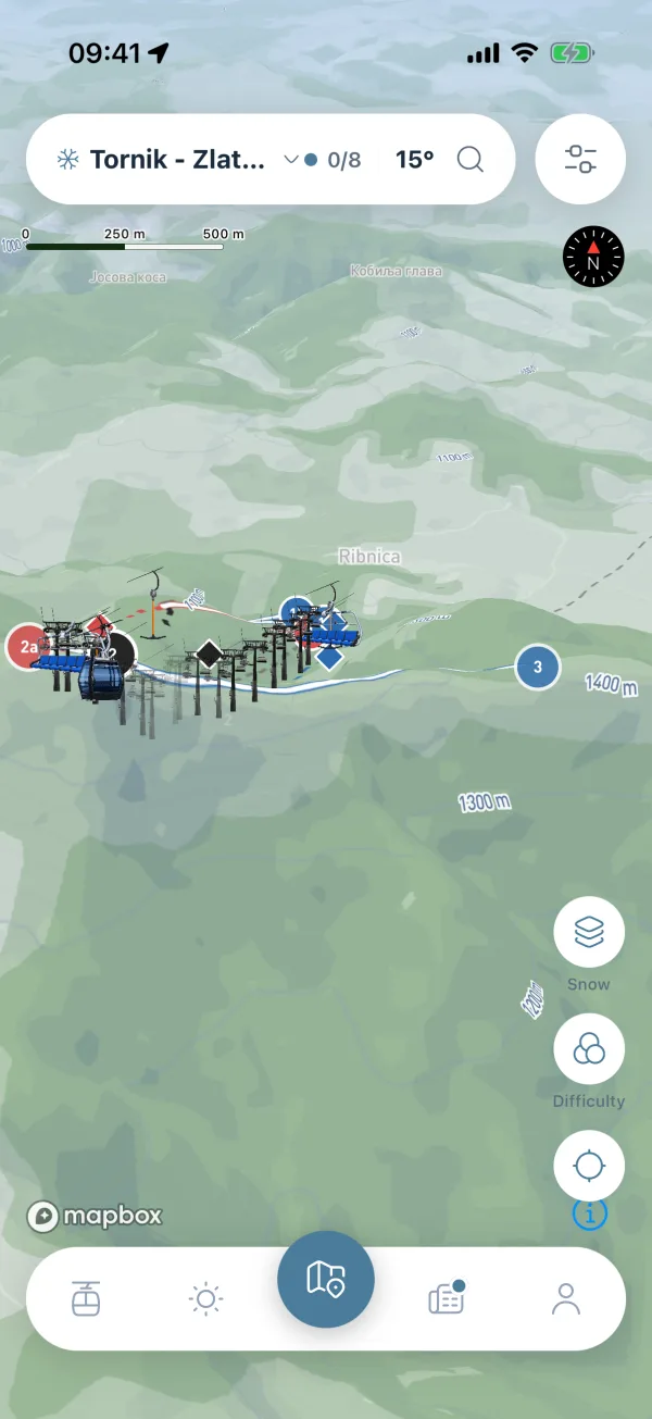
Overview of Kopaonik's lifts and pistes on 3D terrain, with a header island showing the mountain name, the number of open lifts and the temperature. Map with a piste's info panel open, showing its name, difficulty, length, width, elevation, type and grooming. Mountain and season sheet listing the three mountains, with Winter chosen instead of the green season. Green season on Kopaonik: the pistes are gone and hiking trails are drawn on summer terrain, with a leaf next to the mountain name. Zlatibor's Tornik area on the map, with the mountain picker in the header showing none of the eight lifts open and the runs coloured by difficulty.
Map with a hiking trail's info panel open, showing its name, difficulty, how long it takes and whether it is open.
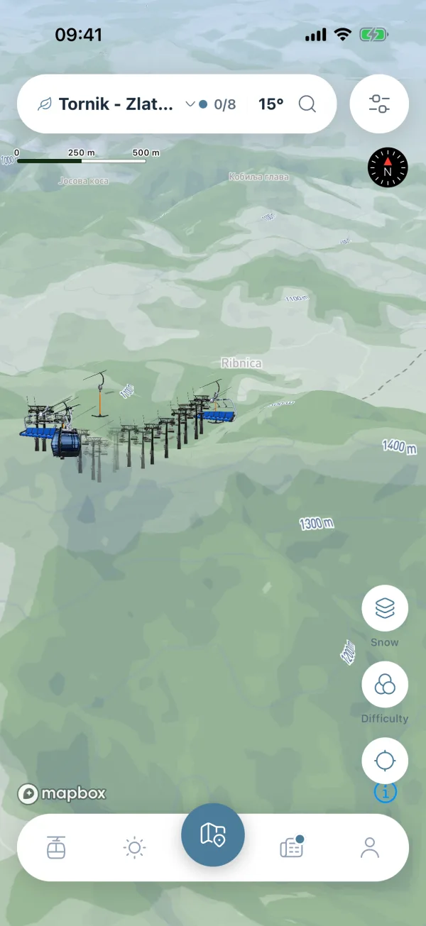
Green season on Kopaonik: the pistes are gone and hiking trails are drawn on summer terrain, with a leaf next to the mountain name. Map with a hiking trail's info panel open, showing its name, difficulty, how long it takes and whether it is open. Mountain and season sheet listing the three mountains, with Winter chosen instead of the green season. Overview of Kopaonik's lifts and pistes on 3D terrain, with a header island showing the mountain name, the number of open lifts and the temperature. Zlatibor's Tornik area in the green season, with the hiking trails drawn on summer terrain and the mountain picker in the header.

Route planner

From where you stand to where you want to be.

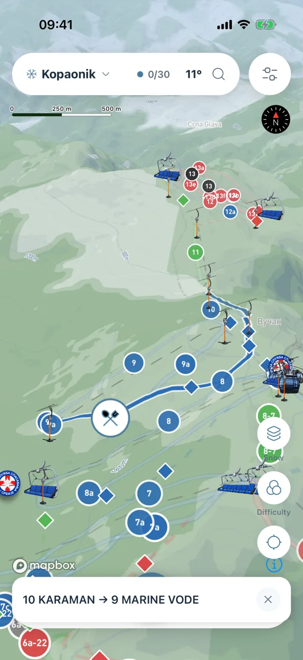
Pick a start and an end: a lift, a tap on the map, or your own position. You get up to three routes over lifts, pistes and ski roads, fastest first. Each one is a step list: ride this lift, take that run, cross this connector, walk the last bit, with the length and minutes of every step.

  • Closed lifts and pistes are left out of the route.
  • If that leaves nothing, it says so and offers the route that ignores closures.
  • The chosen route is drawn on the map, coloured by step.
The chosen route drawn on the map in blue, with a bar at the bottom naming its start and end.
Route planner sheet with a start and an end, and a route broken into steps with the name, length and minutes of each. The chosen route drawn on the map in blue, with a bar at the bottom naming its start and end.

Hiking tours

Pick a walk, then follow it.

In the green season the mountain carries hiking tours and picnic spots instead of pistes. Every tour is put together by hand, with its difficulty and how long it takes, and most of them come with the line of the walk drawn on the map.

  • Difficulty and duration on every tour, picnic spots among them.
  • Open or closed, with a note from the Planina team when a trail is shut.
  • Tap a trail for the details, then follow the line with your own GPS dot.
A hiking trail drawn on the map, with a bar at the bottom naming where it starts and where it ends.
Hiking tours list with each tour's difficulty, how long it takes and whether it is open. Map with a hiking trail's info panel open, showing its name, difficulty, how long it takes and whether it is open. A hiking trail drawn on the map, with a bar at the bottom naming where it starts and where it ends.

Lifts & weather

Know what is running before you put your boots on.

Every lift with its live status: open, limited or closed. You also get its capacity per hour, its type (gondola, six-seat, four-seat, drag lift, conveyor) and when the status was last updated. Lift data comes from Skijališta Srbije.

  • A 7-day forecast with an hour-by-hour breakdown.
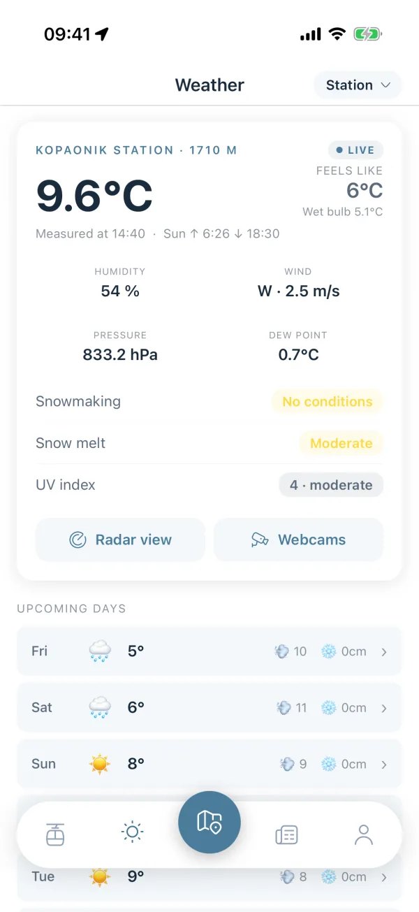
  • The live Kopaonik weather station: feels like, humidity, pressure, wind, dew point, UV, snowmaking conditions and snow melt.
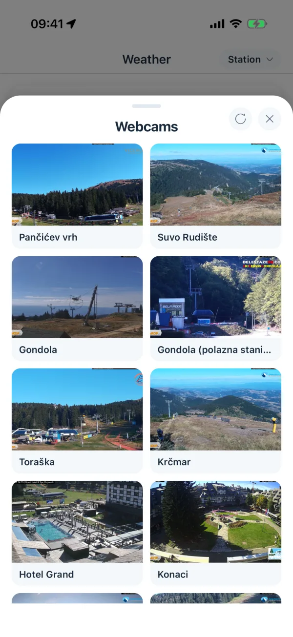
  • Webcams with snapshots and live streams, plus radar.
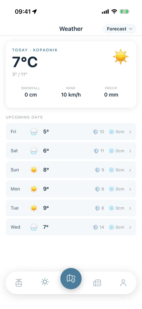
Weather tab with today on Kopaonik, its snowfall, wind and precipitation, and a list of the coming days.
Ski Lifts screen with the open count at the top, filter chips by lift type, and a list of lifts with status, type and hourly capacity. Weather tab with today on Kopaonik, its snowfall, wind and precipitation, and a list of the coming days. Live Kopaonik weather station with temperature, feels like, humidity, wind, pressure, dew point, snowmaking and UV, above the coming days. Webcams sheet with a grid of snapshots from the mountain, each one named after where it stands.

Places & navigation

Find it, then get there, without leaving the app.

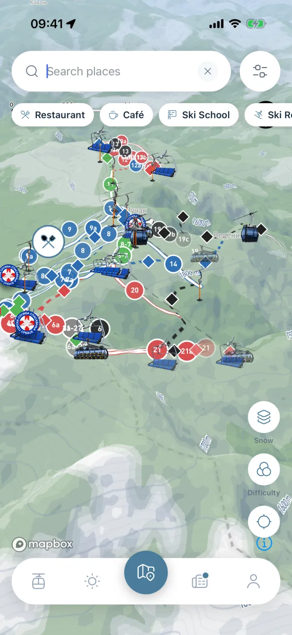
Restaurants, cafés, ski schools, rentals, hotels, first aid, ticket offices, parking, viewpoints, ATMs, taxi, bus, mountain rescue and more. Search understands category tags and their synonyms, and you can narrow it down to places near the pistes.

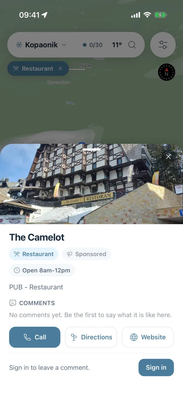
  • Every place has call, directions and website, plus comments with up and down votes.
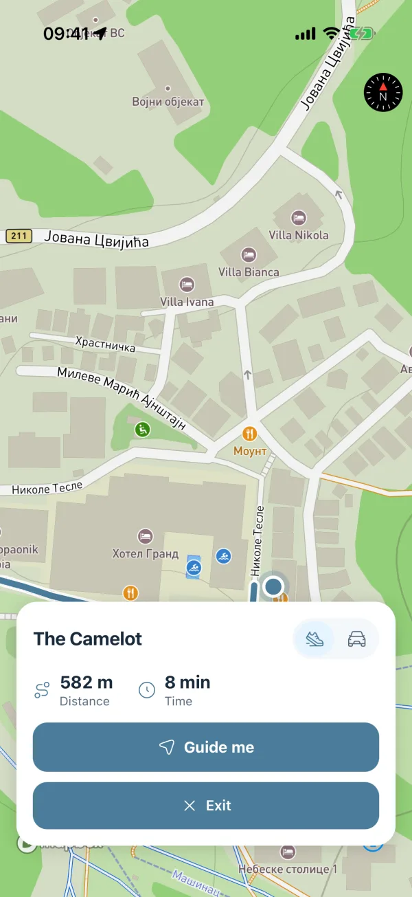
  • Directions are drawn on the map with live distance and time, walking or driving. They are never handed off to Google or Apple Maps.
  • Turn-by-turn "Guide me" comes with a free account.
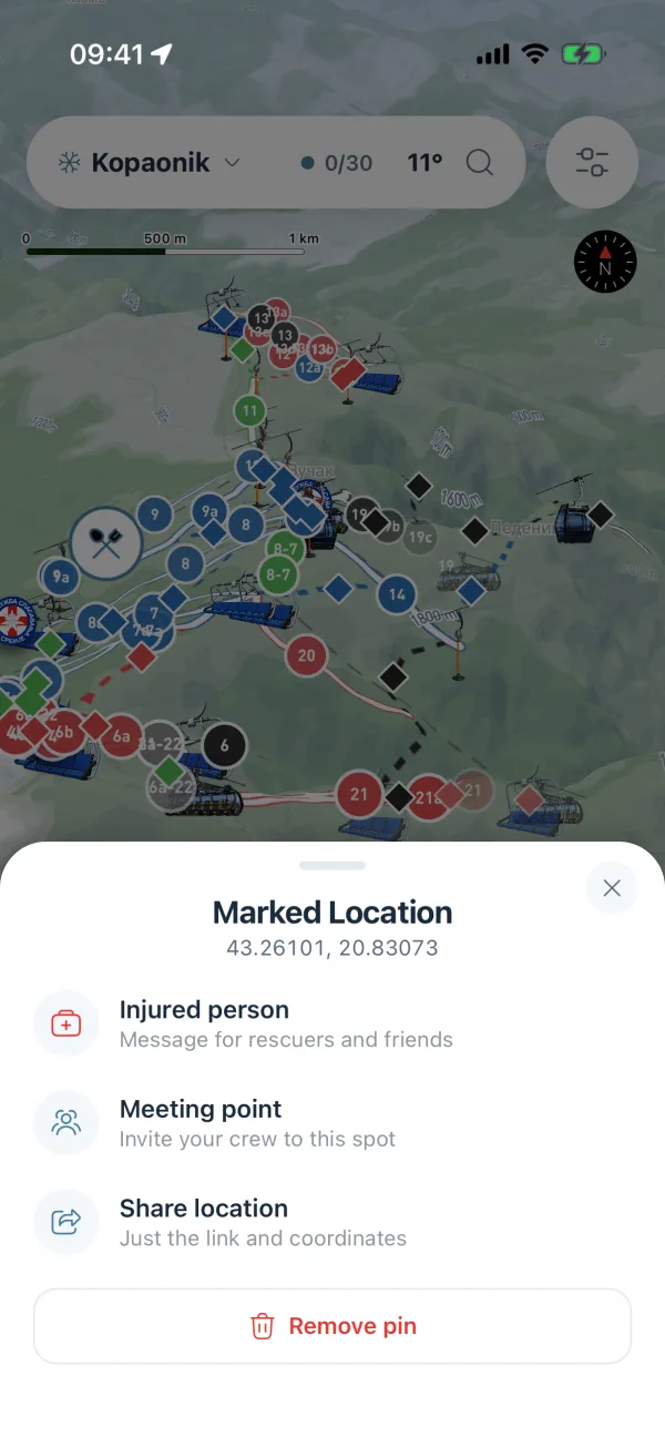
  • Long-press the map to drop a pin and share it: an injury message with coordinates and the 112 emergency number, or just a meeting point for your crew.
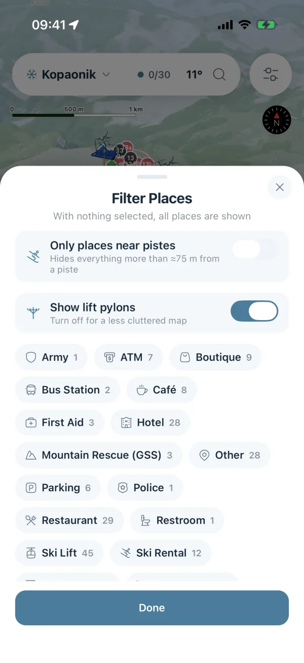
Filter Places sheet with switches for places near the pistes and lift pylons, above category chips with the count of each.
Search over the map with an empty Search places field and category chips for restaurants, cafes, ski schools and rentals. Filter Places sheet with switches for places near the pistes and lift pylons, above category chips with the count of each. Place detail sheet for a restaurant with its photo, opening hours, comments, and call, directions and website buttons. Navigation screen with a line to the destination, the distance and time left, a walk or drive toggle and a Guide me button. Marked Location sheet for a pin dropped on the map, with its coordinates and the choice of injured person, meeting point or share location.

News & community

What is happening on the mountain today.

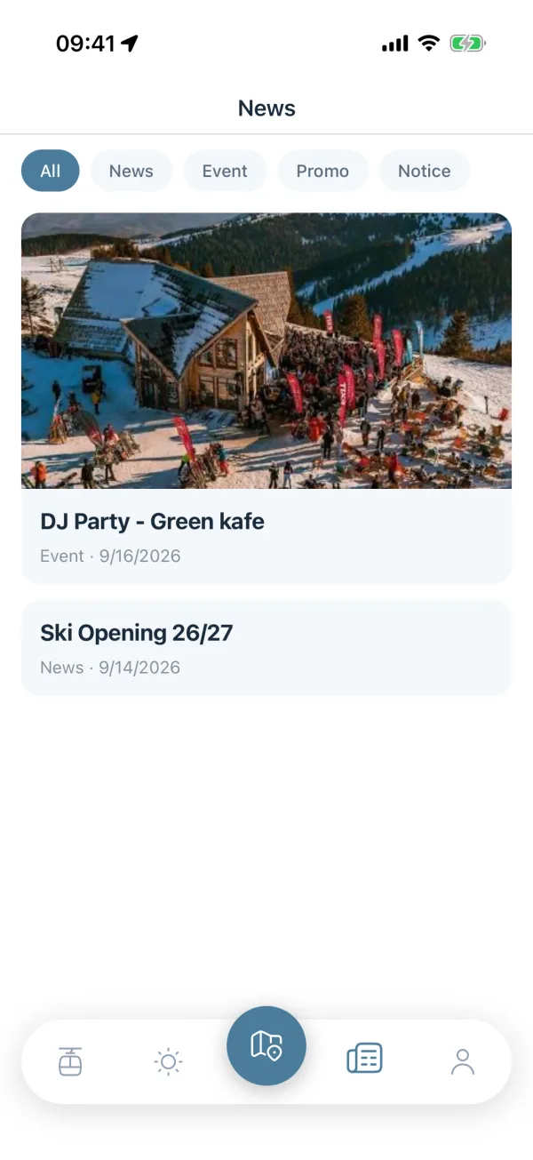
News for your mountain, sorted into categories, with pinned notices on top, cover images and photo galleries. A dot on the News tab tells you there is something new, never a number, never a nag.

  • Read the comments on any article or place without an account.
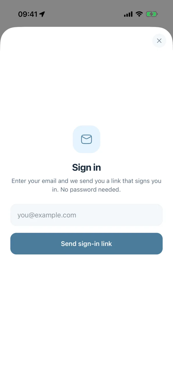
  • Sign in with an email link to post a comment or vote on one.
  • Comments are moderated by the Planina team.
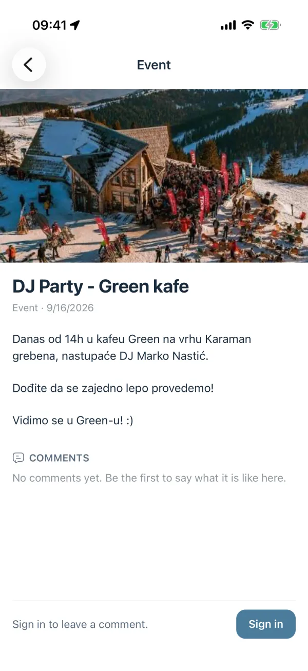
News article opened, with its cover image, the text of the piece and the comments section underneath.
News tab with category chips and a list of articles, each with its cover image, category and date. News article opened, with its cover image, the text of the piece and the comments section underneath.

Help & profile

The numbers you hope never to need.

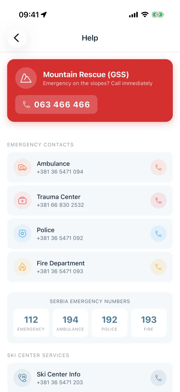
An emergency banner at the top of the Help screen for Mountain Rescue (GSS), the ambulance and the police, then the ski centre's own services. Every number is tap to call, and safety tips sit right underneath.

  • Serbia's emergency numbers 112, 194, 192 and 193, always one tap away.
  • Safety tips for the slopes, from helmets to respecting closures.
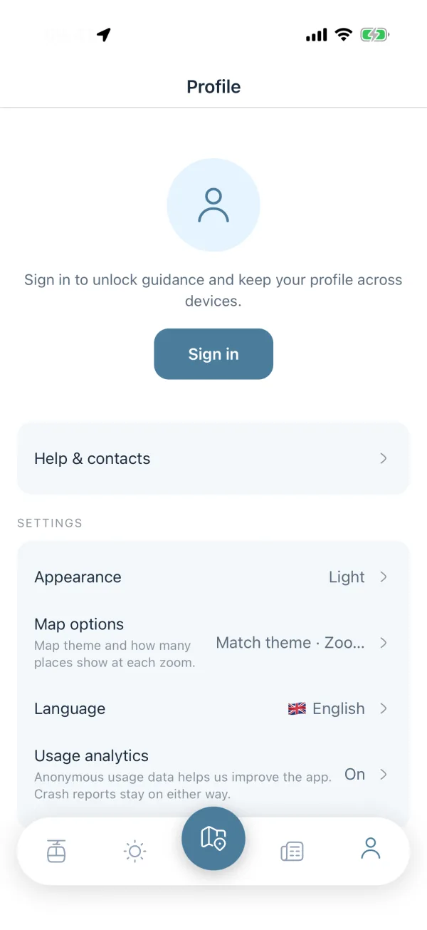
  • Your profile: sign in with an email link, pick light or dark, your map theme and your language.
Profile screen with a sign-in prompt and settings for appearance, map theme and language.
Help screen with the Mountain Rescue banner, tap-to-call emergency contacts and Serbia's emergency numbers. Profile screen with a sign-in prompt and settings for appearance, map theme and language. Sign-in sheet asking for an email address, with a button that sends a sign-in link and no password field.

Coming soon

What comes next.

None of this is in the app yet. It is what we are building after launch, roughly in this order.

  • Coming soon

    Offline maps

    We plan to let you download the whole mountain before you leave the hotel, so the map keeps working where the signal does not.

  • Coming soon

    Morning briefing

    A planned push notification at breakfast with the fresh snow, the pistes that opened and the temperature on the mountain.

  • Coming soon

    Compass mode

    We want the map to rotate with your heading, so the run in front of you is the run in front of you on screen.

  • Coming soon

    Ride tracking

    A planned tracker for your speed, distance and vertical over a day, with lift rides left out of the count.

  • Coming soon

    Offers of the day

    We plan to let places on the mountain post a deal for that day, so you see it while you are standing next to them.

  • Coming soon

    Jahorina next

    Jahorina is the next mountain we plan to map, once the three at launch have been through a full season.

Nine languages

The mountain speaks your language.

Pick one in Profile. Place names, piste names and news follow it, falling back gracefully when a translation is missing.

  • English
  • Srpski
  • Српски
  • Русский
  • Română
  • 中文
  • Български
  • Magyar
  • Македонски

Questions

The things people ask first.

Is it free?

Yes. The map, the route planner, lift status, weather, places, news and reading comments cost nothing and need no account. We pay for the app with sponsored pins and sponsored articles, both clearly marked.

Which mountains does it cover?

Kopaonik, Zlatibor and Stara planina at launch, each mapped piste by piste and lift by lift. Jahorina is the next one we plan to add.

Do I need an account?

Not for the map, the lifts, the weather, the news or reading comments. You sign in with an email link only to be guided turn by turn, to write a comment or to vote on one.

Does it work without a signal?

Not yet. The map tiles, the lift status and the weather all come over the network today, so you need a connection. Offline maps for the whole mountain are planned, and they are the first thing on our list after launch.

Where does the lift status come from?

From Skijališta Srbije, the ski centre operator. Our backend refreshes it on a schedule and the app shows the time of the last update next to the lifts, so you can see how fresh it is.

Which languages does it speak?

Nine: English, Serbian in Latin and Cyrillic, Russian, Romanian, Chinese, Bulgarian, Hungarian and Macedonian. You pick one in Profile and place names, piste names and news follow it.

How do I get my business on the map?

A basic pin with your name, category and location is free for every place on the mountain, so write to us and we will add you. Sponsored pins and sponsored articles are the paid options, sold per season.

When does it launch?

We are aiming at the 2026/27 winter season, on iOS and Android at the same time. Leave your email above and you get one message on the day it is out.

For partners

Be on the map the day they arrive.

Restaurants, ski schools, rentals and hotels: reach the people already standing on your mountain, holding the map of it. Two ways in, both honest and clearly marked as sponsored.

Sponsored pin

Your place keeps its real category. A restaurant stays a restaurant, but it stays visible whatever filters the skier has set, comes first in search results, and carries a "Sponsored" badge in its detail sheet.

  • Visible regardless of the user's filters
  • Listed first in search
  • Call, directions and website on the pin

Sponsored article

A piece in the News tab of your mountain with a photo gallery, sorted ahead of the rest, badged with your name and a link back to you.

  • Badge with sponsor name and link
  • Sorted ahead of other articles
  • Cover image and photo gallery

A basic pin with your name, category and location is free for every place on the mountain. The sponsored packages are the paid part, and they are sold per season.

Comments on pins and articles are moderated by the Planina team.

Coming soon to iOS & Android

The whole mountain, in your pocket.

Free. The map, the lifts, the weather, the news and reading comments need no account. You only sign in to be guided, to comment and to vote.